Places to Go
Blue Lake
 The Blue Lake
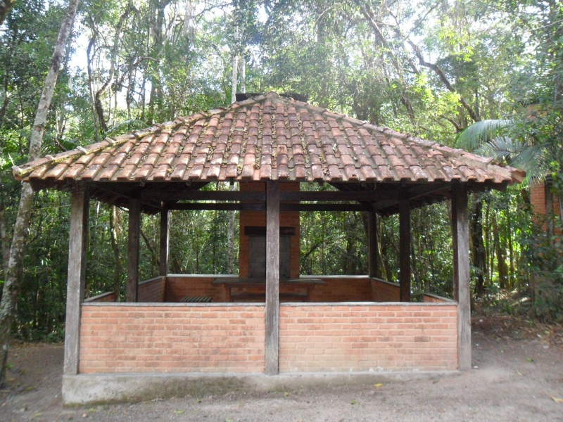
The Blue Lake is the natural attraction nearest to the Visitors Center, about 500 meters from it. The trail is very accessible for the whole family, except its stair with approximately 120 steps, which requires care on the part of older people or those with limited mobility. There is a second option to this trail, longer and without steps, allowing a lighter and safer walk. The trails lead to a natural pool on the Campo Belo River, a site recommended for swimming. Near the pool there are kiosks that can be used for an extra charge, paid at the entrance of the park.
Blue Lake Kiosk
The Blue Lake Kiosk is available from 08h00 to 17h00 for the visitor as a space for snacks and family meals.
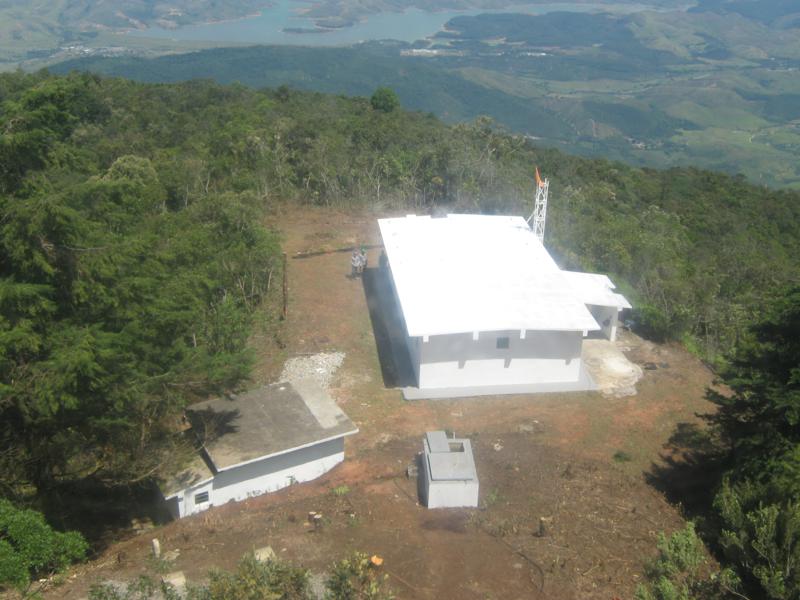
Visitor's Center

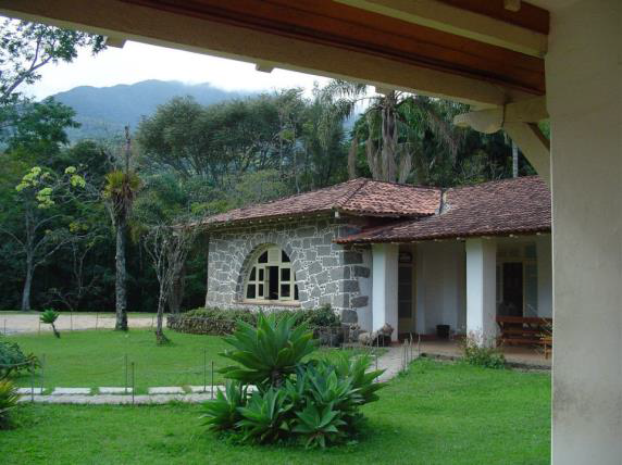
- The park receives a significant number of visitors and the Visitor's Center is its informational epicenter.
- The main hall Presents the Itatiaia National Park in the National, Regional and Local context through panels with maps
- A scale model of the park shows its different regions in three dimensions.
- The exhibition discovering the park presents panels with geological, historical, botanical and zoological information about the Park and its surroundings.
- The travelling exhibitions room presents artistic, cultural and environmental projects.
- The interactive room is an area for educational activities.
- The mountaineering exhibition retraces the history of mountain climbing in the Park even before its founding.
- The Tom Jobim auditorium is the meeting point for cultural and institutional events. A video library is available to visitors.
- The wildlife sidewalk reproduces the footprints of various wild animals that live in the Atlantic Forest.
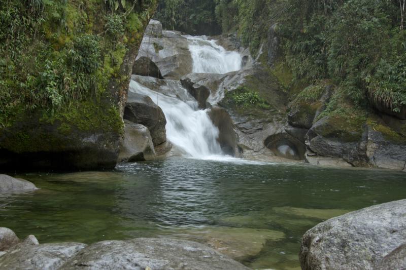
Moromba Site
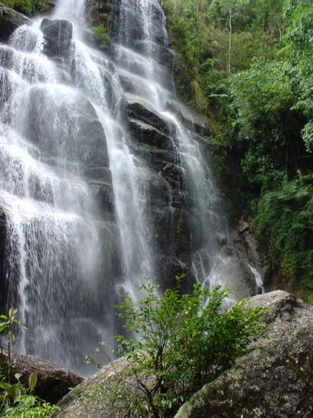
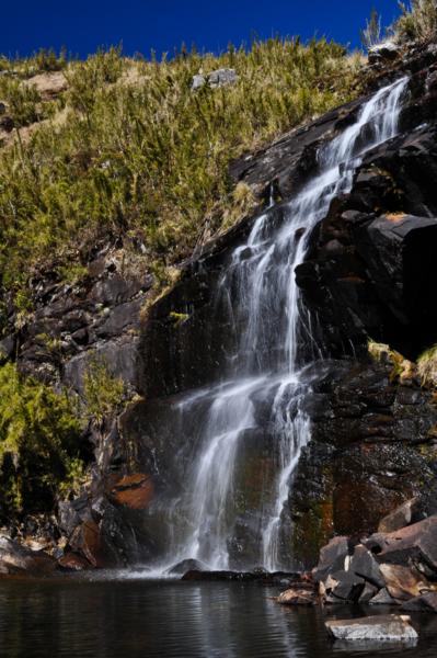
Wedding Veil Waterfall
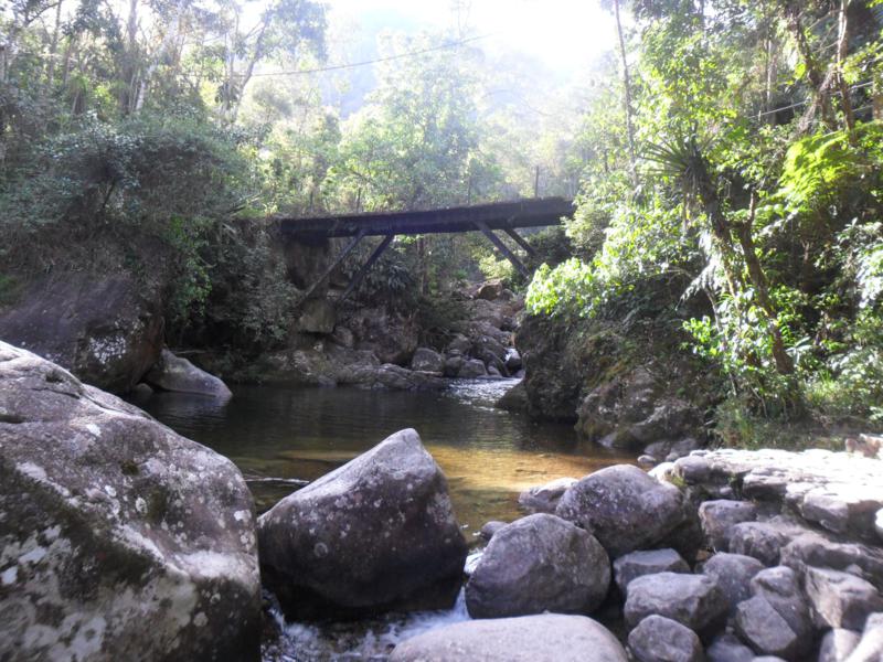
The Area of Maromba is 4 km uphill from the Visitors Center. This area is comprised of a natural swimming pool, the Itaporani Waterfall and the Wedding Veil Waterfall. You can access these three sites by parking after the bridge.
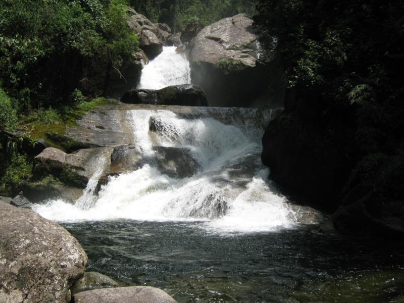
The Maromba Natural Swimming Pool
The Maromba Swimming Pool is located at an altitude of 1100 meters. It is where the river calms down to form a large natural pool, which can be accessed via a stair about 50 meters tall. Due to its large size, the pool is often used by experienced swimmers.
Itaporani Waterfall
The Waterfall Itaporani, is about 620 meters from the bridge. Located at the end of a trail that enters into the forest. Down the plastic wood stairs, visitors can see the beautiful waterfall and the pool it forms.
On the way to the Itaporani Waterfall, another trail about 260 meters long branches off, leading to the Wedding Veil waterfall. At the end of a rustic trail, after a plastic wood bridge and stone stairs, you arrive at a part of the Maromba River that suddenly drops from a height of 40 meters, forming a beautiful waterfall. In the summer, the rain swells the river, forming a serene and beautiful veil of mist from which the waterfall gets its name.
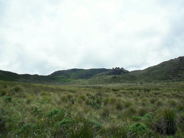
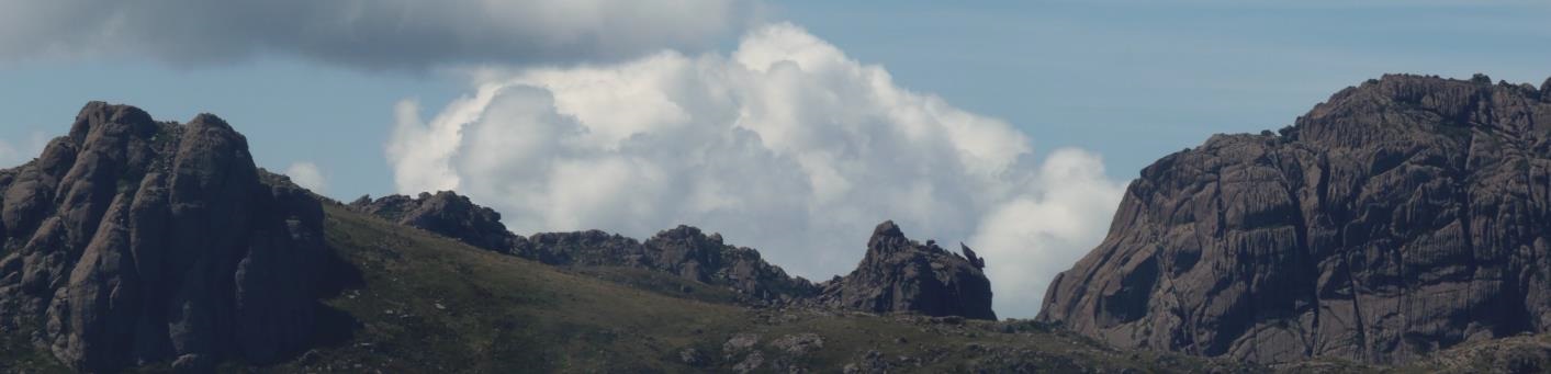
Three Peaks
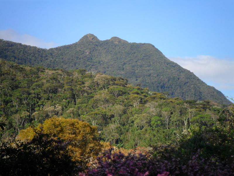
Three Peaks
The Three Peaks is another site that can be accessed via a steep 6 km trail inside the Atlantic Rainforest. This challenge requires almost all day to trek. The overlook offers a good view of the Paraiba river valley, the park, and the foothills of the Serra da Mantiqueira and Serra do Mar. For secure access it is recommended that visitors be accompanied by a local guide. Check the list of registered guides.
Foundation Stone
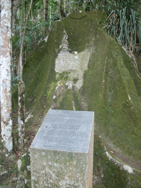
Foundation Stone
FOUNDATION STONE, reads: "Marker of the first
National Park of Brazil. The president of the republic Getúlio
Vargas, and the Minister of Agriculture Dr. Odilon Braga established
The Itatiaia National Park by Decree-Law 1713 on June 14, 1937".
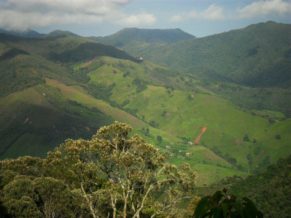
Last Goodbye Overlook
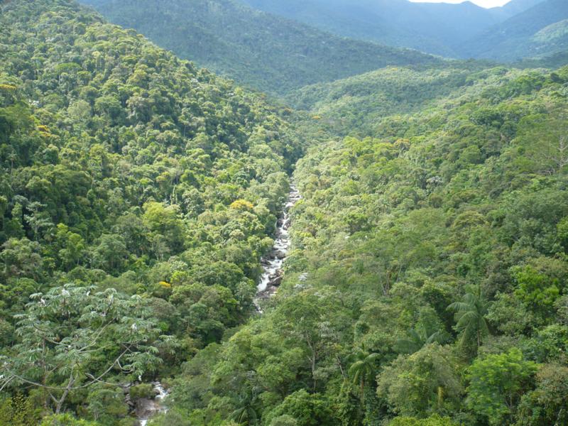
View from the Last Goodbye Overlook
The Last Goodbye Overlook has a privileged panoramic view of the park, the Campo Belo River Valley and the Serra do Mar.
To visit the plateau, visitors must sign the Terms of Responsibility. Speed up your check in by printing it out here.
Agulhas Negras Peak
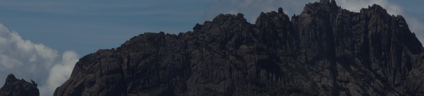
The Agulhas Negras massif is the main elevation on the plateau, its highest point is at 2791.55 m, being the highest point of the park and the fifth highest in the country (IBGE, 2011).
The visitor has the option to just walk to the base or to scale to the summit, but it is necessary that these choices be defined at the entrance (Marcão gate) where there is a visitor’s checkpoint.
The massif has several climbing routes with varying levels of difficulty, some of which are only accessible to climbers with experience and adequate equipment. Access to the base is easy, without too much rugged terrain.
The summit of the Agulhas Negras massif offers a beautiful panoramic view of the region.
Maciço das Prateleiras
 |
 |
 |
 |
 |
Shelves Massif is formed by huge blocks of rock, its highest point being 2,540 m above sea level. It lies in a region of altitude grasslands and has one of the most beautiful panoramic views of the Paraiba River Valley. Next to the massif are several well-known and popular sites like the Apple Stone, Turtle Stone, and Seated Stone.
The trail to the shelves starts next to the Rebouças Shelter entrance.
From the beginning of the trail to the base of the shelves, the path is about 3 km long, and takes on average 1.5 hours.
Safety equipment is needed to ascend to the peak of the shelves, which should be checked at the gate of the park. It takes approximately 1 hour longer to make it from the base to the peak of the shelves. The diversity of attractions in this area offer not only beautiful views of the park and the Paraíba River Valley, but also the presence of peculiar formations allow for the practice of trekking, climbing and rappelling.
Morro do Couto

A moderate walk takes us to the second highest point of the park, the Couto Stone, a rock formation 2681 meters high, with a privileged view of the Paraíba River Valley, Serra Fina and other frequently visited sites: the peaks of the Agulhas Negras, the Shelves, the Altar stone, as well as Hermes’ Wing. Along the access path to the Couto stone, there is a stone wall with many climbing and rappelling routes largely used for training and practice.
Aiuruoca Waterfall
Voltado para Minas Gerais, oVale do Aiuruoca, conta com a geladíssimaCachoeira do Aiuruócae a formação rochosaOvos da Galinha. Para chegar o visitante terá que fazer uma caminhada moderada, a partir do Abrigo Rebouças. No caminho, podem-se ver as formaçõesAsa do HermesePedra do Altar.
Altar Stone
The Altar Stone, at an altitude of 2665 meters, this rock formation is accessed by following the trail to its highest point. On top of the Altar Stone, through which the Rio de Janeiro / Minas Gerais state line passes, it is possible to view the main attractions of the Itatiaia Plateau, including the Shelves, the Agulhas Negras, Hermes’ Wing, the Bell Stone, and Sierra Negra.
Reboucas Shelter
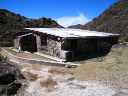
Rebouças Shelter
At the moment, the Rebouças Shelter has 16 vacancies for hosting (beds with mattresses), at a cost of R$ 32.00 per person / day, in addition to entry rates. The shelter has a kitchen with gas stove, tables for dining and bathrooms with cold showers.
There is no cell phone signal at this area.
With its construction already completed in the first half of the 1950s, under the management of Wanderbilt Duarte de Barros, the Rebouças Shelter became the highest public shelter in Brazil (altitude 2,350 meters). Its name honors the civil engineer, botanist and geologist André Pinto Rebouças (1838-1898), a pioneer in several subjects, standing out as a militant abolitionist, and in his time, one of the biggest motivators for the creation of national parks.
Near the shelter, the Campo Belo river dam is part of a small hydroelectric system which for some time provided energy to the building, but being unable to produce sufficient charge, it was eventually disabled. In 1997 subterranean cabling provided electricity to the shelter once again. For many years, before the construction of the present gatehouse (Posto Marcão), the shelter served as housing for employees of the Park, who remained there usually on 15 day shifts, sharing the premises with climbers, hikers, tourists and other visitors.
Now, part of the premises of the shelter is permanently reserved for use by the Park.
- Click here to see the rules for using the shelter.
- For reservationsclick here.
Camping Site
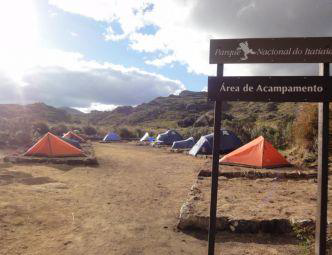 Camping Site
CAMPING IS INDEFINITELY INTERDICTED BECAUSE OF THE EMERGENCY WORKS IN SEWER SYSTEM.
Beside the Rebouças Shelter, there is a camp site, with twenty (20) vacancies (3x3 meters) for tents up to 3 people. Only fifteen (15) vacancies may be reserved, the other five (5) will be available for visitors who arrive without reservation at the Marcão Gate entrance. These vacancies will be occupied in order of arrival. The user cost of camping is R$ 19.00 per person / day, plus the entrance fee.
Click here to see the rules for using the shelter..
For reservations.Click here.
Ruy Braga

Ruy Braga Crossing(Rebouças - Head office low part)
- Trekking permitted in both directions - Rebouças / Low Region and Low Region / Rebouças;
- The maximum capacity is 20 (twenty) people / day;
- Overnight stay is permitted in the Massenas shelter or Água Branca Shelter, but should be specified at the time of entry;
- The crossing can be made within two (2) days, or one day, without an overnight stay;
- The person responsible for the group must inform the group’s arrival and departure at the checkpoints below.
- If the trail is started on the plateau, the group should be checked-in at the Marcão checkpoint;
- If the trail is started in the Low Region of the park, the group should check-in at the Maromba post, and in the event of it being later than 17h00, check-in should be done at service station 2, located near the park administration.
- In either case (going up or down), the trek should start no later than 10h00.
Água Branca Shelter
Água Branca Shelter
This new park shelter sits at the top of the mountain along the Ruy Braga crossing, and is an invitation for visitors to contemplate the sunrise and sunset.
The Agua Branca shelter is one of the overnight options for the Ruy Braga crossing, this shelter can house 10 people, and can be used at a fee of R$10,00 per person / day, plus the admission fee. This shelter does not have electricity, but it does have water and cell phone signal. It is made up of rooms with four beds and mattresses, a bath with a cold shower, and a dining area. This shelter does not have a cooking stove or gas.
Click here to see the rules for use and occupation in the shelter água branca..
Crossing The Serra Negra (Waterfall Santa Clara)
- Trek permitted only in the Rebouças / Maua direction, arriving in the area of the Santa Clara waterfall;
- The route starts at the Marcão post, passes by Rebouças and then leads to the Aiuruoca waterfall, after which the path follows the Aiuruoca river channel, eventually joining the old path at two wooden buildings known as the Aiuruoca Cabins;
- The maximum capacity of this route is forty (40) people / day;
- The location allowed for overnight stay is a private area called Matão;
- The crossing can be made in up to two days, or one day, without an overnight stay;
- At the end of the journey, the person responsible for the group should deposit the control card in the urn at the Visconde de Maua Post, and contact the park by phone (24) 3352-1292 / 3352-2288 / 3352-6894 or by email:This email address is being protected from spambots. You need JavaScript enabled to view it.">This email address is being protected from spambots. You need JavaScript enabled to view it. to inform them of the group’s departure;
- The Park is not responsible for the reservation of the overnight area in Matão. Once you have obtained permission from the park to make the crossing, you should make direct contact with the area’s owner to schedule overnight stay;
- The trek must start before 10h00.
Crossing The Rebouças - Mauá (via rancho Caído)
 Crossing permitted only in the Rebouças / Maua direction, arriving in the valley of the Crosses or Escorrega waterfall.
- The itinerary begins at the gate of the Park (Marcão Post), passing by the Rebouças Shelter along the path that leads to the Aiuruoca Waterfall, from there to the Chicken Eggs rock formation, continuing into the Valley of the Dinosaurs (source of the Black river), then to the Fallen Ranch (coordinates: latitude 22 º 22 '11.66 "South - longitude 44 º 38' 04.41" W), finally going down a steep hill that leads into the woods, arriving in the valley of crosses or the Escorrega Waterfall
- Maximum capacity of twenty (20) people / day;
- The only site permitted for overnight stay is the area of the Fallen Ranch (coordinates: latitude 22 º 22 '11.66 "South - longitude 44 º 38' 04.41" W). Users should pay very careful attention, obeying the environmental laws, bringing back all their trash and dealing with human waste appropriately;
- The crossing can be made within two days; or in a day without overnight stay;
- At the end of the journey the person responsible for the group should deposit the control card in the urn at the Visconde de Maua Post, and contact the park by phone (24) 3352-1292 / 3352-2288 / 3352-6894 or by email:This email address is being protected from spambots. You need JavaScript enabled to view it. This email address is being protected from spambots. You need JavaScript enabled to view it.">to inform them of the group’s departure;
- The trek must start before 10h00.